Cerrillos (Cerrillos Hills)
Deposit type & geology
Polymetallic veins and turquoise deposits associated with an Oligocene intrusive complex — silver-lead-zinc-copper dominant, with gold only ever a trace byproduct.
Cretaceous sedimentary rocks intruded by Oligocene monzonite/latite porphyry stocks and dikes.
Age: Intrusive complex ~34 Ma (Oligocene) — part of the same regional alkaline magmatic episode as the nearby Ortiz Mountains and New Placers/Golden districts.
Structural geology & terrain
Vein/structure orientation: Not independently detailed this session
Named controlling structure: Not independently confirmed this session
Elevation range: 6,000–6,900 ft
Low hills of the Cerrillos Hills, now largely a state park with maintained hiking trails.
High-resolution terrain
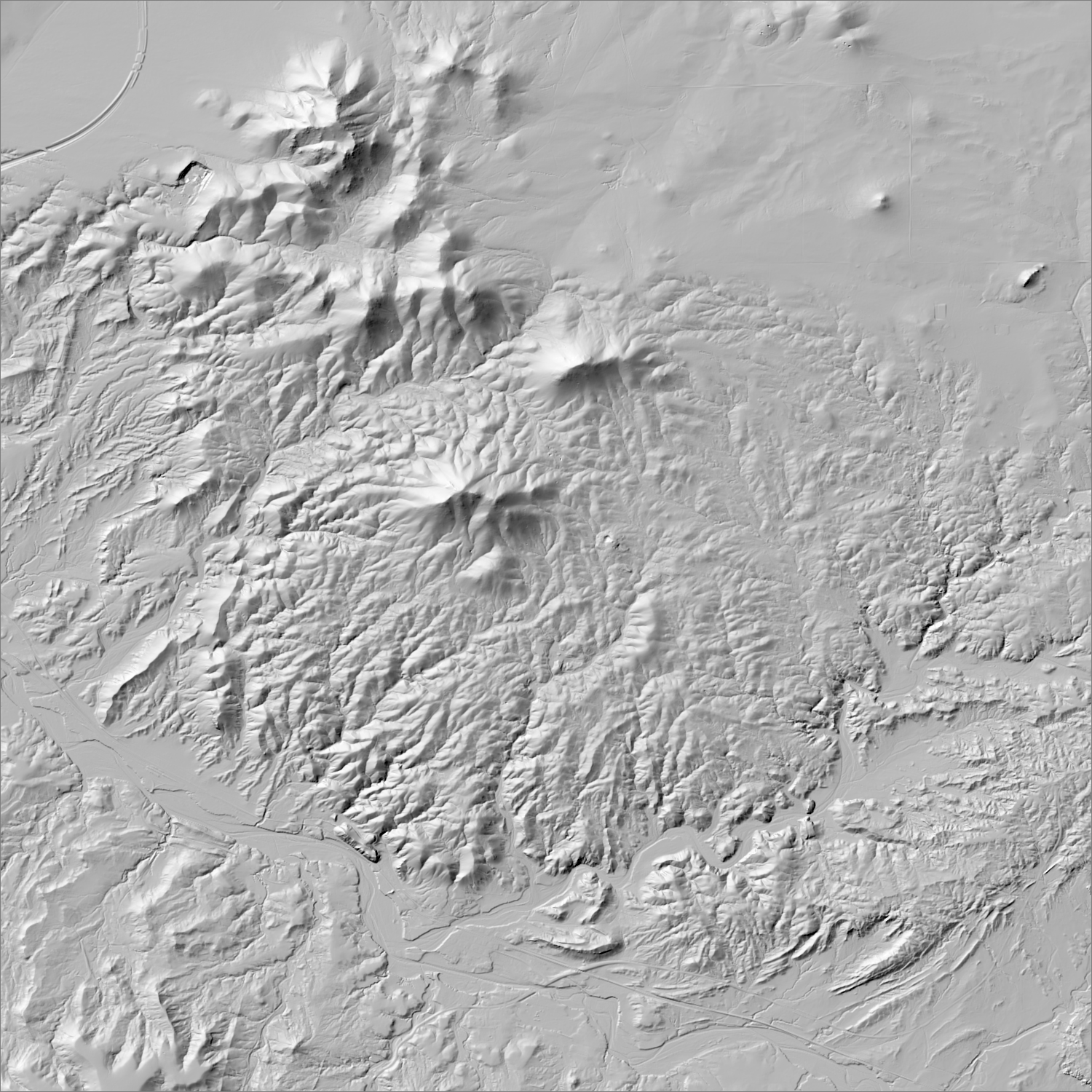
~6 m/pixel lidar-derived hillshade (USGS 3DEP) — fine enough to reveal old mine workings, waste-rock piles, trenches, and roads the statewide terrain layer can’t show.
Historical production
No itemized gold total found in any source — historic production was silver-lead-zinc-copper-turquoise dominant; one of the oldest mining districts in the US (turquoise and lead mined here for over 1,000 years, predating European contact), with an 1879 boom bringing gold-copper claims (e.g. the Evelyn and Grand Central mines both list gold as a secondary commodity), but no source found quantifies a district-wide gold figure.
Sources: NMBGMR RM-24 (McLemore, DIS180); NMBGMR Circular 77 (File, Directory of Mines of New Mexico); USGS MRDS; Cerrillos Hills State Park / EMNRD historic-preservation documentation; cerrilloshills.org researched — see sources
Current status
Effectively closed to new mining. The district was legally defunct as a formal mining district by 1889, and its southern portion is now Cerrillos Hills State Park (1,125 acres, transferred to state ownership 2009) with historic mine openings safeguarded/netted for public safety and interpretive viewing rather than access. No current claims permitted by any landowner (county, state, federal, or private) per EMNRD's own historic-preservation documentation.
Dormant — no recent activity
No mining claims of any kind are currently permitted — the southern portion of the historic district is now Cerrillos Hills State Park (1,125 acres, NM State Parks since 2009), and per EMNRD's own historic-preservation documentation, no county, state, federal, or private landowner currently allows new claims in the district.
Land ownership & directions
Public land held by a city or similar body, typically as open space or parkland — generally closed to new mineral entry regardless of federal mining law.
Mixed: Cerrillos Hills State Park (NM State Parks), with adjoining private, patented, and public-domain parcels — mixed ownership is itself cited as an obstacle to district-wide preservation. Village of Cerrillos, Santa Fe County, on the Turquoise Trail (NM-14); ~5 miles of state park hiking trails through the southern portion.
See specimen photos (mindat.org) → — this app doesn’t host specimen photos itself; this searches mindat.org’s own mineral-specimen database, which isn’t necessarily specific to this exact district.
This pin is a generalized district/historic-site reference point, not a surveyed claim boundary — routes may cross private or patented inholdings where public access isn’t guaranteed even if a road reaches the site. Backcountry mine areas commonly have unmarked shafts, unstable ground, and no cell service; confirm current access and safety conditions (land manager, county, or landowner) before heading out.
Tailings reprocessing potential
Contemporary sources describe gold here as "never much more than a trace" even at the district's silver-lead-copper-turquoise production peak — combined with the district's current State Park status foreclosing any reprocessing regardless of tailings quality.
This is a documentary heuristic, not assay data.The tier above is inferred from historic production era, processing method, and ore character already cited elsewhere on this page — nobody has sampled or assayed this district’s tailings as part of this research. Actual recoverable gold content can only be established by physical sampling.
Reprocessing tailings is regulated mining. Disturbing or reprocessing historic mill waste requires the same NM Mining Act permitting as new mining (see the regulatory companion guide), regardless of who currently holds the claim or surface rights — and ownership of the tailings material itself is a separate legal question from mineral rights on the underlying land.
Legacy tailings can be hazardous. Pre-modern processing commonly used mercury (amalgamation) or cyanide (heap leach), and can carry elevated arsenic and other heavy metals — not a casual sampling target, and disturbing contaminated material can carry real environmental liability.
Geologist’s read
Distinct from both the Ortiz Mountains/Old Placers (~9 mi S) and New Placers/Golden (~11 mi S) districts despite sharing the same broad Oligocene alkaline magmatic event — added this session after independent MRDS and literature confirmation, but included here mainly for completeness and contrast: this is a real, ancient, and culturally significant mining district that was never meaningfully a gold play, now permanently preserved as parkland rather than available for any renewed mineral interest.