Elizabethtown-Baldy
Deposit type & geology
Great Plains Margin alkaline, placer-dominant.
Alkaline intrusive-related mineralization in the Moreno Valley, Cimarron porphyry belt.
Age: Oligocene alkaline igneous activity (Cimarron porphyry belt).
Structural geology & terrain
Vein/structure orientation: Aztec Mine N40–66°W/20–60°NE
Named controlling structure: No single named through-going fault identified — the Pierre Shale/Raton Formation contact is the primary stratigraphic control
Elevation range: 8,000–12,441 ft (Baldy Mountain summit)
Steep Cimarron Range, ponderosa/fir/aspen grading to alpine tundra; historically very hard access — a 9,000-ft exploration tunnel driven 1916–1933 failed to reach ore.
High-resolution terrain
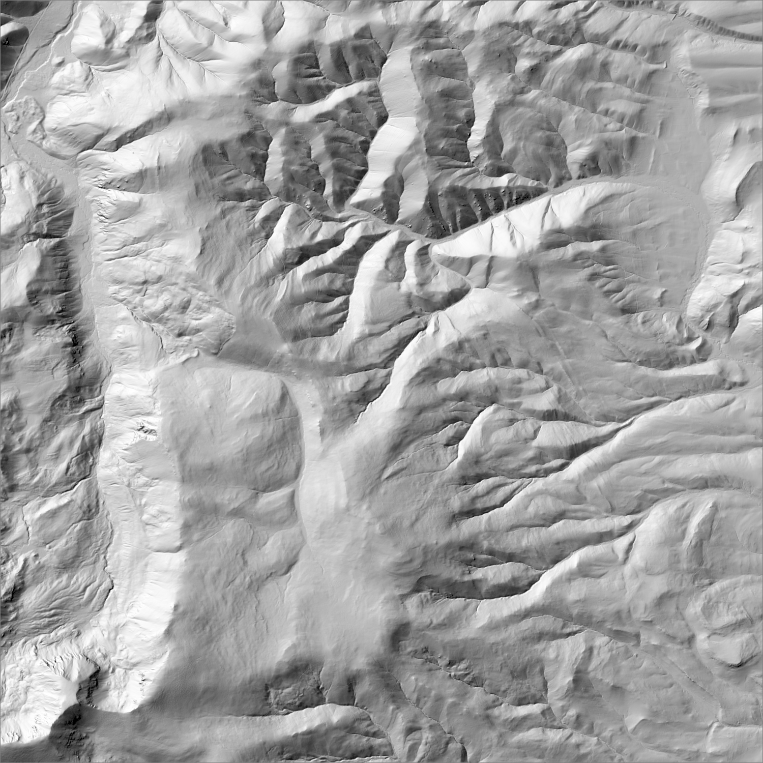
~6 m/pixel lidar-derived hillshade (USGS 3DEP) — fine enough to reveal old mine workings, waste-rock piles, trenches, and roads the statewide terrain layer can’t show.
Historical production
Four conflicting totals across sources gathered this session: 471,400 oz Au (McLemore "Gold in New Mexico" deck, NMBGMR — the figure used for this map's stat, independently re-confirmed by NMBGMR Lite Geology #9, Fall 1994) versus 250,000 / 145,138 / ~143,000 oz Au from the USGS Bulletin 1348 (Johnson 1972) source lineage. None of these are reconciled in the literature — New Mexico's 2nd-largest gold district by production under the higher figure, meaningfully smaller under the Bulletin 1348 lineage. Major production ended by 1905 following the failure of the Eleanor dredge.
Sources: Wikipedia (Baldy Mining District, cross-checked); Legends of America; goldrushnuggets.com; McLemore “Gold in New Mexico” (NMBGMR); USGS Bull. 1348 (Johnson 1972); NMBGMR Lite Geology #9 (Fall 1994) researched — see sources
Current status
Inactive. Most district land is now part of Philmont Scout Ranch (Boy Scouts of America). No current claims, permits, or exploration activity identified.
Dormant — no recent activity
No claims, permits, or exploration activity identified — most of the district is Philmont Scout Ranch land.
Land ownership & directions
Privately held — a mix of patented mining claims, ranch land, and corporate holdings. Mineral and surface rights may be held separately (split estate); accessing or exploring here requires the owner's permission or a lease/purchase agreement, not a BLM claim filing.
Predominantly private (Philmont Scout Ranch). Near Eagle Nest, NM, off US-64.
See specimen photos (mindat.org) → — this app doesn’t host specimen photos itself; this searches mindat.org’s own mineral-specimen database, which isn’t necessarily specific to this exact district.
This pin is a generalized district/historic-site reference point, not a surveyed claim boundary — routes may cross private or patented inholdings where public access isn’t guaranteed even if a road reaches the site. Backcountry mine areas commonly have unmarked shafts, unstable ground, and no cell service; confirm current access and safety conditions (land manager, county, or landowner) before heading out.
Tailings reprocessing potential
Dominated by dredge placer mining (the 1905 Eleanor dredge failure is well documented); dredges historically left significant recoverable fine gold, but the district sits on private Philmont Scout Ranch land with no public access, regardless of tailings quality.
This is a documentary heuristic, not assay data.The tier above is inferred from historic production era, processing method, and ore character already cited elsewhere on this page — nobody has sampled or assayed this district’s tailings as part of this research. Actual recoverable gold content can only be established by physical sampling.
Reprocessing tailings is regulated mining. Disturbing or reprocessing historic mill waste requires the same NM Mining Act permitting as new mining (see the regulatory companion guide), regardless of who currently holds the claim or surface rights — and ownership of the tailings material itself is a separate legal question from mineral rights on the underlying land.
Legacy tailings can be hazardous. Pre-modern processing commonly used mercury (amalgamation) or cyanide (heap leach), and can carry elevated arsenic and other heavy metals — not a casual sampling target, and disturbing contaminated material can carry real environmental liability.
Geologist’s read
A large, well-documented alkaline-belt gold district that is now functionally closed to exploration by land ownership (a scouting organization's working ranch) rather than by geology or regulation — a reminder that land-access status can foreclose a district as effectively as a bad drill result.