Eureka District
Deposit type & geology
Skarn/replacement plus placer gold; Southern Silver's more recent work targets a gold-copper porphyry system at depth.
Not independently detailed this session — Little Hatchet Mountains.
Age: Not independently confirmed this session.
Structural geology & terrain
Vein/structure orientation: Not researched this session.
Named controlling structure: Not researched this session.
Elevation range: Not researched this session.
Not researched this session.
High-resolution terrain
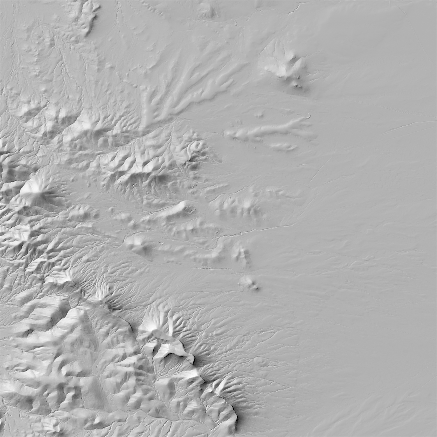
~6 m/pixel lidar-derived hillshade (USGS 3DEP) — fine enough to reveal old mine workings, waste-rock piles, trenches, and roads the statewide terrain layer can’t show.
Historical production
$1,590,000 combined production, 1878–1961 (USGS MRDS spatial sweep) — no separate troy-ounce figure found. Newly added this session: independently corroborated by two separate research threads (an MRDS spatial sweep and Streetwise Reports coverage of Southern Silver Exploration Corp's "Oro" project), which is the reason this district was added to the map after not appearing in the original 31.
Sources: USGS MRDS spatial sweep (candidate_new_districts.csv); Streetwise Reports (2017, Southern Silver Exploration Corp coverage — promotional, flagged) researched — see sources
Current status
No current production. Southern Silver Exploration Corp drilled the "Oro" gold-copper porphyry target here as of 2017 with encouraging intercepts, but has published no further work since and its current investor materials focus exclusively on a Mexico project — treat this as a dormant/stale lead, not active exploration, until current claim status is verified via EMNRD or BLM MLRS.
Recency not verified
Southern Silver Exploration Corp's "Oro" gold-copper porphyry project reported drill results in 2017 (9.1m at 0.75 g/t Au within a 41.2m interval at 0.42 g/t Au); no coverage since, and the company's current disclosures are entirely about a Mexico project — this is a stale lead. Current claim status (whether Southern Silver or anyone else still holds ground here) was not confirmed this session.
Land ownership & directions
Land ownership for this district was not independently confirmed in this session's research — verify directly before relying on it.
Little Hatchet Mountains, Grant/Hidalgo county line — not independently confirmed this session. Bootheel region, Little Hatchet Mountains.
See specimen photos (mindat.org) → — this app doesn’t host specimen photos itself; this searches mindat.org’s own mineral-specimen database, which isn’t necessarily specific to this exact district.
This pin is a generalized district/historic-site reference point, not a surveyed claim boundary — routes may cross private or patented inholdings where public access isn’t guaranteed even if a road reaches the site. Backcountry mine areas commonly have unmarked shafts, unstable ground, and no cell service; confirm current access and safety conditions (land manager, county, or landowner) before heading out.
Tailings reprocessing potential
Historic processing method and mill scale not established in the sources reviewed this session.
This is a documentary heuristic, not assay data.The tier above is inferred from historic production era, processing method, and ore character already cited elsewhere on this page — nobody has sampled or assayed this district’s tailings as part of this research. Actual recoverable gold content can only be established by physical sampling.
Reprocessing tailings is regulated mining. Disturbing or reprocessing historic mill waste requires the same NM Mining Act permitting as new mining (see the regulatory companion guide), regardless of who currently holds the claim or surface rights — and ownership of the tailings material itself is a separate legal question from mineral rights on the underlying land.
Legacy tailings can be hazardous. Pre-modern processing commonly used mercury (amalgamation) or cyanide (heap leach), and can carry elevated arsenic and other heavy metals — not a casual sampling target, and disturbing contaminated material can carry real environmental liability.
Geologist’s read
Added this session after independent corroboration from both a systematic MRDS spatial sweep (which flagged it as a real district with quantified production, not currently on the map) and a 2017 Streetwise Reports article on Southern Silver's porphyry target — two unrelated sources converging on the same place was the bar for adding a new district this pass. That said, this entry has much less research depth than the original 31 districts: no structural/vein geometry, elevation, or terrain data was found this session, and the most recent exploration lead is nearly a decade stale.