Hillsboro-Kingston / Copper Flat
Deposit type & geology
Laramide porphyry Cu(-Au-Ag) + radial polymetallic veins + carbonate-hosted Ag-Mn-Pb + placer.
Cretaceous andesite volcanics intruded by the Copper Flat quartz monzonite porphyry.
Age: Andesite host ~75.4 Ma; Copper Flat porphyry ~74.9 Ma (Laramide).
Structural geology & terrain
Vein/structure orientation: Copper Flat breccia pipe fractures perpendicular to a NE fracture trend; Hillsboro veins radiate NE from Copper Flat (12+ named veins, e.g. Bonanza N37°E/80–90°NW, Rattlesnake N75°E/65°NW); Kingston principal fractures trend N40°W
Named controlling structure: Hunter, Patten, Greer, Olympia, and Lewellyn faults at Copper Flat (three trends: NE/WNW/ENE); Bullion Fault at Kingston (at the Lady Franklin, N15°W/55°SW)
Elevation range: Hillsboro 5,236 ft; Copper Flat 5,440 ft; Kingston 6,249–7,001 ft; surrounding peaks to 10,100 ft
Copper Flat sits in an eroded basin; Hillsboro in the Animas Hills foothills; Kingston in the rugged, forested Black Range — "rough, travel is difficult" per source.
High-resolution terrain
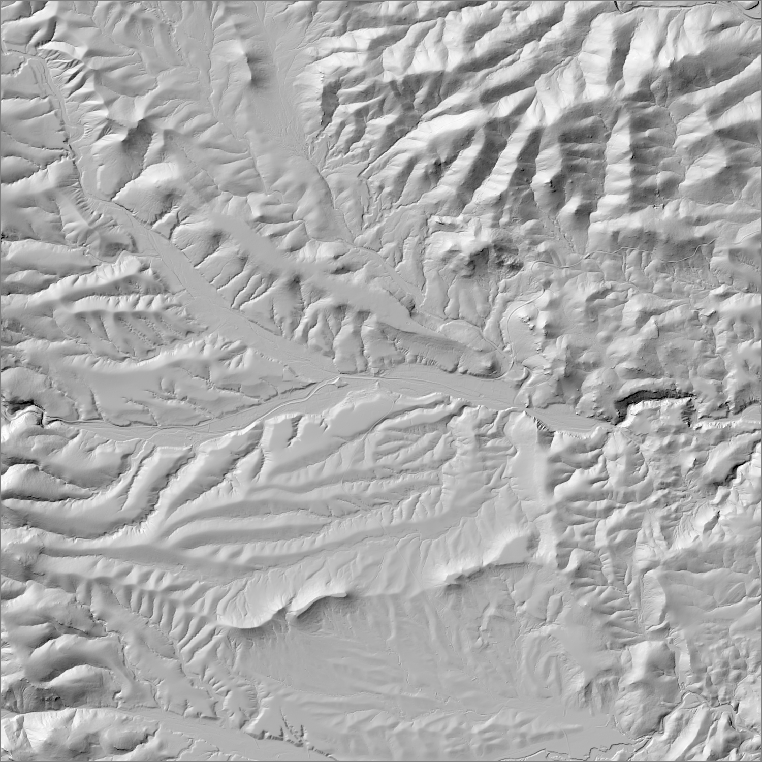
~6 m/pixel lidar-derived hillshade (USGS 3DEP) — fine enough to reveal old mine workings, waste-rock piles, trenches, and roads the statewide terrain layer can’t show.
Historical production
Hillsboro district: ~149,000 oz Au through 1959 (Western Mining History), about two-thirds from placers; Sierra Co.-wide total ~183,900 oz Au. Kingston sub-district: ~6M oz Ag, 1883–93. One of only four NM districts with over 100,000 oz of placer gold.
Sources: NMBGMR (McLemore, Copper Flat porphyry system page); Western Mining History; EMNRD SI027RN permit file; Wikipedia (Kingston, cross-checked) researched — see sources
Current status
Historic gold/silver lode and placer mining is inactive. The Copper Flat porphyry-copper deposit at the district center has a long-pending EMNRD permit (SI027RN) held by New Mexico Copper Corp (THEMAC Resources Group) — amended Mine Operation & Reclamation Plan submitted Sept. 2025, several approvals still outstanding; a brief 1980–82 open-pit operation (Quintana Minerals) is the only recent production. NMBGMR also names Hillsboro as one of five NM districts with ongoing recreational panning today (with Jicarilla, White Oaks, Pittsburg, and Orogrande).
Active within ~12 months
New Mexico Copper Corp (THEMAC Resources) submitted an amended Copper Flat Mine Operation & Reclamation Plan (permit SI027RN); several approvals still outstanding.
Land ownership & directions
The district spans more than one ownership type (e.g., patented claims inside BLM or National Forest land) — check the specific parcel, not just the district, before assuming access.
Mix of BLM and private land, east flank of the Black Range. ~25 mi SW of Truth or Consequences via NM-152.
See specimen photos (mindat.org) → — this app doesn’t host specimen photos itself; this searches mindat.org’s own mineral-specimen database, which isn’t necessarily specific to this exact district.
This pin is a generalized district/historic-site reference point, not a surveyed claim boundary — routes may cross private or patented inholdings where public access isn’t guaranteed even if a road reaches the site. Backcountry mine areas commonly have unmarked shafts, unstable ground, and no cell service; confirm current access and safety conditions (land manager, county, or landowner) before heading out.
Tailings reprocessing potential
Placer-dominant history plus older (1877–1930s) stamp-mill vein processing; the modern Copper Flat porphyry was never built, so no tailings exist there specifically.
This is a documentary heuristic, not assay data.The tier above is inferred from historic production era, processing method, and ore character already cited elsewhere on this page — nobody has sampled or assayed this district’s tailings as part of this research. Actual recoverable gold content can only be established by physical sampling.
Reprocessing tailings is regulated mining. Disturbing or reprocessing historic mill waste requires the same NM Mining Act permitting as new mining (see the regulatory companion guide), regardless of who currently holds the claim or surface rights — and ownership of the tailings material itself is a separate legal question from mineral rights on the underlying land.
Legacy tailings can be hazardous. Pre-modern processing commonly used mercury (amalgamation) or cyanide (heap leach), and can carry elevated arsenic and other heavy metals — not a casual sampling target, and disturbing contaminated material can carry real environmental liability.
Geologist’s read
Placer-dominant gold history here traces directly back to the radial vein swarm around the Copper Flat stock eroding into the surrounding gulches — a textbook case of a porphyry system's peripheral veins outperforming the porphyry core itself for gold, even though the modern permitting effort targets the low-grade copper core. A separate MRDS spatial sweep flagged the adjacent Hermosa (Palomas) District (Sierra Co., DIS196, <$2M production 1879–) as sitting on the Black Range's east slope between the Apache and Kingston districts, with its own formal district code — likely worth treating as part of this same Hillsboro-Kingston-Copper Flat cluster rather than a standalone entry, though this map does not fold its specific production figures in.