Tertiary andesite/rhyolite (Last Chance Andesite, Fanney Rhyolite) of the Mogollon-Datil volcanic field, along the Bursum Caldera ring-fracture system.
Age: Host volcanics ~28–36 Ma; vein mineralization dated 15–18 Ma at the Queen vein (2023 U-Pb calcite study) — notably younger than the caldera itself.
Named controlling structure: Named veins/faults above — no single master fault identified
Elevation range: ~6,500–7,500 ft
Steep Mogollon Mountains at the Gila Wilderness edge; narrow Silver Creek Canyon access, difficult.
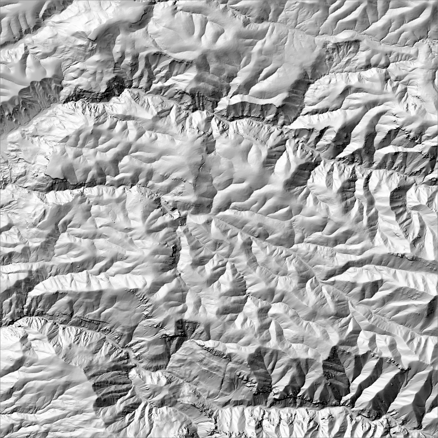
High-resolution terrain
~6 m/pixel lidar-derived hillshade (USGS 3DEP) — fine enough to reveal old mine workings, waste-rock piles, trenches, and roads the statewide terrain layer can’t show.
Historical production
Multiple conflicting totals: 271,000 oz Au + 13.1M oz Ag (1904–25, Ferguson/USGS Bull. 787 via Silver47)
Sources: 1904–25, Ferguson/USGS Bull. 787 via Silver47 researched — see sources
339,000 oz Au + 16.4M oz Ag (1904–42, same underlying source per Summa Silver)
Sources: 1904–42, same underlying source per Summa Silver researched — see sources
~362,000 oz Au county-wide through 1959 (Koschmann & Bergendahl/USGS)
Sources: Koschmann & Bergendahl/USGS researched — see sources
Current status
Active exploration. Silver47 Exploration Corp (formerly Summa Silver) holds ~7,730 acres and is drilling depth extensions of high-grade silver-gold veins; only ~1.7 km of a mapped 34 km vein system has been drill-tested. NM EMNRD Minimal Impact Exploration permit CA027EM, approved 2021, renewed through late 2025/2026.
U.S. Forest Service land — open to mineral entry under the 1872 Mining Law, but surface use is regulated by the Forest Service and may include wilderness-adjacent or sensitive-area restrictions.
Gila National Forest. ~22 mi south of Reserve, NM via NM-78; unpaved mountain road, high-clearance recommended; elev. ~7,000–8,500 ft.
See specimen photos (mindat.org) → — this app doesn’t host specimen photos itself; this searches mindat.org’s own mineral-specimen database, which isn’t necessarily specific to this exact district.
This pin is a generalized district/historic-site reference point, not a surveyed claim boundary — routes may cross private or patented inholdings where public access isn’t guaranteed even if a road reaches the site. Backcountry mine areas commonly have unmarked shafts, unstable ground, and no cell service; confirm current access and safety conditions (land manager, county, or landowner) before heading out.
Tailings reprocessing potential
Higher tailings potential
High-grade veins processed by early cyanide-mill technology (1904–1942); Silver47's own drilling notes most of the 34 km vein system remains untested — era and scale both favor residual gold in historic mill tailings.
This is a documentary heuristic, not assay data.The tier above is inferred from historic production era, processing method, and ore character already cited elsewhere on this page — nobody has sampled or assayed this district’s tailings as part of this research. Actual recoverable gold content can only be established by physical sampling.
Reprocessing tailings is regulated mining. Disturbing or reprocessing historic mill waste requires the same NM Mining Act permitting as new mining (see the regulatory companion guide), regardless of who currently holds the claim or surface rights — and ownership of the tailings material itself is a separate legal question from mineral rights on the underlying land.
Legacy tailings can be hazardous. Pre-modern processing commonly used mercury (amalgamation) or cyanide (heap leach), and can carry elevated arsenic and other heavy metals — not a casual sampling target, and disturbing contaminated material can carry real environmental liability.
Geologist’s read
Sits directly on the Bursum Caldera's western ring-fracture zone — the same structural control that localizes most of the district's veins. The Queen vein dating shows mineralization postdates caldera collapse by ~10–13 million years, consistent with the Mogollon-Datil field's broader pattern of veins forming during post-caldera cooling/resurgence rather than at the eruptive climax. The bulk of the district's own mapped vein length remains untested at depth.
Period newspaper mentions from the Library of Congress’s Chronicling America archive — supplementary color on a district’s activity over time, not a research signal or evidence of gold potential. Matched by place name, not manually verified per item.
“Til K EAGLE WEDNESDAY NOVEMBER 7 1894 5 THE MOGOLLON MAIL ROUTE was thrown to the ground in spite of his efforts to save himself and one of the trunks rolled completely over him lie…”
“…ecord in this office at tiro oclock p tn on the Fifteenth day of June A D 19CH CERTIFICATE OF EXTENSION OF CORPORATE EXISTENCE OF MOGOLLON MERCANTILE CO No 4445 and alKo that I have compared the fol lowing copy of the name with the original thereof now on tile and de…”
“…Y SEPTEMBER 3 1910 SUBSCRIPTION JJioo A YEAR SHOT ONLY WHEN PRESSED SAYS CAPTAIN fOUff Will Use Every Measure to Restore Order in Mogollon In Spite of Opposition of Dive Keepers and Vicious Element Says Clark Fired First Shot With Win chester Before Volley From Retrea…”
“…nd Owner SUBSCRIPTION TRICKS Three Monthi llOfl Six Months I One Year 00 Sitbscrirtion Always Payable In Advance WHO WILL GET THE MOGOLLON BUSINESS i Chilly cold Keg Beer with crisp ice beads on the glass On Tap at all times The S price of Copper may be high but the p…”
“…2fi I wilt glvo flovornor McDonald Juun n no vrlll prove Hint Mr Ilurstim got ono rout of graft munoy out of Uio building of thn MogollonHoccqrro county road In 1080 Till Ih tlm unoqulvocnl statement mado to thn Bllvor City Enterprise by Unelo llnrry llormunn for thi…”
Modern exploration & drilling
Current NI 43-101/S-K 1300 disclosure from active operators — a different thing from the historical production above (ounces already mined). These are estimates of gold/silver still in the ground and the specific drill intercepts behind them, not resource reserves ready for production.
Mogollon Project (Silver47 Exploration Corp. (formerly Summa Silver Corp.)) — Inferred, 2,716,000 t at 138.8 g/t Ag, 2.72 g/t Au (367.4 g/t AgEq), containing 12,117,000 oz Ag, 238,000 oz Au (32,083,000 oz AgEq) (effective 2024-11-22), per NI 43-101.
MOG22-10 (Queen Vein, Consolidated Target): 4.26 g/t Au, 306 g/t Ag over 9.91 m
including 12.9 g/t Au and 1,002.1 g/t Ag over 1.95 m
The source PDF's text lists this second value as 'g Au/t', but every other paired intercept in the same report lists Au then Ag, and 306 g/t is implausible as a bulk-interval gold grade for this deposit style. Very likely a transcription artifact for 'g Ag/t' in the source filing — shown as printed, not silently corrected.
MOG23-20 (Queen Vein, South Queen Target): 3.92 g/t Au, 64 g/t Ag over 7.44 m (247.8–248.26 m depth)
including 28.62 g/t Au and 320 g/t Ag over 0.46 m
The 247.80–248.26 m depth given in the source is for the 0.46 m high-grade sub-interval specifically (shown in includesNote), not necessarily the full 7.44 m interval's own start/end depth — reported here as the best available depth reference.