New Placers (Golden / San Pedro Mountains)
Deposit type & geology
Contact-metasomatic (skarn) copper-gold-silver-tungsten deposits plus mesothermal gold-quartz-pyrite veins and placer.
Mid-Tertiary monzonite/latite porphyry stocks and laccoliths (the San Pedro laccolith group) intruding Pennsylvanian Madera Limestone; gold veins are mainly hosted in hornfels.
Age: Laccoliths ~33.7–33.9 Ma; younger mineralization-related stocks ~28.3–29.4 Ma — part of the same Ortiz porphyry belt magmatic event as the Ortiz Mountains, but structurally isolated from it by a fault system with over 5,000 ft of vertical displacement.
Structural geology & terrain
Vein/structure orientation: No strike/dip found; pyrometasomatic replacement follows the "marble line" contact at the San Pedro Mine; the Carnahan pipe sits at the intersection of an E-trending fault and a N-trending cross-fault
Named controlling structure: E-trending monzonite porphyry dike, interpreted as the fluid conduit; the "marble line" contact itself
Elevation range: 7,539 ft (San Pedro Mine)
Low rolling range with chronic historic water scarcity — placer-operation wells were drilled 500–800 ft deep.
High-resolution terrain
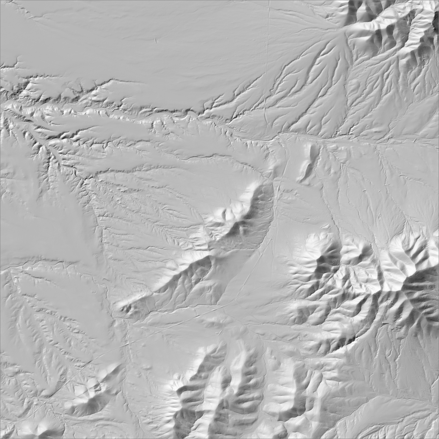
~6 m/pixel lidar-derived hillshade (USGS 3DEP) — fine enough to reveal old mine workings, waste-rock piles, trenches, and roads the statewide terrain layer can’t show.
Historical production
~115,700 oz Au total (96,759 oz placer to 1902/1904, per Lindgren, Graton & Gordon 1910/USGS PP 68, plus ~2,900–3,000 oz placer and ~16,000 oz lode 1904–1957, per Koschmann & Bergendahl 1968 via USGS Bulletin 1348) — one of only four NM districts to exceed 100,000 oz of placer production alone. The San Pedro copper-gold-silver skarn mine alone produced more than 13 million lb of copper since 1900 (Atkinson 1961, NMBGMR Bulletin 77). Discovery year is given as both 1832 and 1839 within the same NMBGMR Circular 5 — an internal inconsistency in the source itself, not resolved here.
Sources: NMBGMR Bulletin 77 (Atkinson 1961); New Mexico Geology v.27 n.1 (Maynard 2005); NMBGMR Bulletin 81 (Elston 1967); NMBGMR Circular 5; EMNRD AML San Pedro Mine Safeguard Project I & III researched — see sources
Current status
Dormant. No gold exploration, claims, or permits identified in the 2010s–2020s. EMNRD's Abandoned Mine Land Program completed a multi-phase San Pedro Mine Safeguard hazard-remediation project (backfilling pits/shafts, bat gates) as recently as 2020, distinct from any new mining. NM Bureau of Geology's own placer-gold synthesis attributes the district's dormancy in part to permitting and environmental restrictions.
Dormant — no recent activity
No confirmed gold exploration or claims activity in the 2010s–2020s; NMBGMR's own placer-gold synthesis states permitting/environmental restrictions have hampered recent production. The only current land use tied to historic claim names is an unrelated gravel/aggregate quarry (San Pedro Rock, LLC) on BLM land.
Land ownership & directions
The district spans more than one ownership type (e.g., patented claims inside BLM or National Forest land) — check the specific parcel, not just the district, before assuming access.
Mixed private (Ortiz Mine Grant), BLM, and small NM State Trust parcels. Village of Golden, NM, on the Turquoise Trail (NM-14) between Santa Fe and Madrid; the mountains lie half a mile SE of Golden (T12N R7E).
See specimen photos (mindat.org) → — this app doesn’t host specimen photos itself; this searches mindat.org’s own mineral-specimen database, which isn’t necessarily specific to this exact district.
This pin is a generalized district/historic-site reference point, not a surveyed claim boundary — routes may cross private or patented inholdings where public access isn’t guaranteed even if a road reaches the site. Backcountry mine areas commonly have unmarked shafts, unstable ground, and no cell service; confirm current access and safety conditions (land manager, county, or landowner) before heading out.
Tailings reprocessing potential
Placer-dominant overall, but the San Pedro skarn mine (1904–1967) ran a copper-focused mill where gold and silver were byproducts, not the target.
This is a documentary heuristic, not assay data.The tier above is inferred from historic production era, processing method, and ore character already cited elsewhere on this page — nobody has sampled or assayed this district’s tailings as part of this research. Actual recoverable gold content can only be established by physical sampling.
Reprocessing tailings is regulated mining. Disturbing or reprocessing historic mill waste requires the same NM Mining Act permitting as new mining (see the regulatory companion guide), regardless of who currently holds the claim or surface rights — and ownership of the tailings material itself is a separate legal question from mineral rights on the underlying land.
Legacy tailings can be hazardous. Pre-modern processing commonly used mercury (amalgamation) or cyanide (heap leach), and can carry elevated arsenic and other heavy metals — not a casual sampling target, and disturbing contaminated material can carry real environmental liability.
Geologist’s read
Geological twin of the Ortiz Mountains/Old Placers district just to the north — same regional alkaline porphyry belt, same skarn-plus-vein-plus-placer deposit style — but structurally isolated from it by a fault system with over 5,000 ft of vertical displacement, and hosted in older (Pennsylvanian) limestone rather than the Ortiz belt's younger Jurassic-Cretaceous host rocks. The two are often confused or conflated in casual references; NMBGMR treats them as related but genuinely separate intrusive centers.