Ortiz Mountains / Old Placers
Deposit type & geology
Great Plains Margin alkaline — laccolith-related veins, breccia pipes, skarn, and NM's largest gold placer.
Twelve laccoliths of the Ortiz porphyry belt (quartz andesite / monzonite to monzodiorite) intruding Cretaceous-Tertiary sediments.
Age: Laccoliths 33.2–36.2 Ma; younger mineralized stocks 27.9–31.4 Ma; gold mineralization itself dated 31.6–32.2 Ma — recording the transition from Laramide compression to Rio Grande Rift extension.
Structural geology & terrain
Vein/structure orientation: Ortiz open-pit vein N15°E/75°NW at the brecciated stock margin
Named controlling structure: Tijeras–Cañoncito Fault System (pre-mineralization control); Ortiz Graben (up to 4,000 ft of stratigraphic separation on its SE side)
Elevation range: ~7,474–8,858 ft (Placer Peak)
Moderate relief; vegetation grades sagebrush → pinyon-juniper → ponderosa → mixed conifer with elevation.
High-resolution terrain
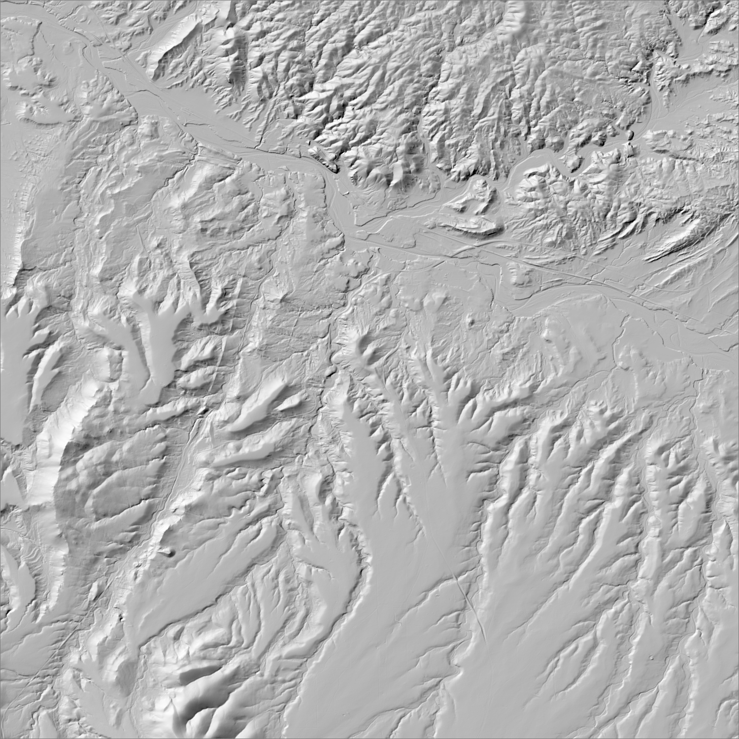
~6 m/pixel lidar-derived hillshade (USGS 3DEP) — fine enough to reveal old mine workings, waste-rock piles, trenches, and roads the statewide terrain layer can’t show.
Historical production
450,000 oz Au — the single largest gold-producing district in New Mexico. First NM gold discovery (1828), inaugurating the state's placer era. Documented styles include the Carache Canyon breccia (4.5M t @ 3.2 g/t Au) and Lukas Canyon Au-Cu skarn (5.4M t @ 1 g/t Au).
Sources: New Mexico Geology v.27 n.1 (Maynard 2005); NMBGMR Circular 5; McLemore “Gold in New Mexico” (NMBGMR); EMNRD SF002RE permit file; NM Environmental Law Center case notes researched — see sources
Current status
No new mining. The Cunningham Hill portion (1979–87 heap-leach open pit) is under active EMNRD-overseen reclamation (permit SF002RE) by Homestake Mining Co. of California (formerly LAC Minerals/Barrick) for pit-slope stability and legacy cyanide/nitrate groundwater remediation — approved revision as of Dec. 2024.
Renewed interest (1–3 yrs ago)
EMNRD approved a Cunningham Hill reclamation permit revision (SF002RE, Rev. 20-1) covering pit-slope stability and waste-rock remediation — reclamation activity, not new mining.
Land ownership & directions
Privately held — a mix of patented mining claims, ranch land, and corporate holdings. Mineral and surface rights may be held separately (split estate); accessing or exploring here requires the owner's permission or a lease/purchase agreement, not a BLM claim filing.
Predominantly private (Ortiz Mine Ranch). ~20 mi south of Santa Fe near Cerrillos/Madrid, NM-14 corridor.
See specimen photos (mindat.org) → — this app doesn’t host specimen photos itself; this searches mindat.org’s own mineral-specimen database, which isn’t necessarily specific to this exact district.
This pin is a generalized district/historic-site reference point, not a surveyed claim boundary — routes may cross private or patented inholdings where public access isn’t guaranteed even if a road reaches the site. Backcountry mine areas commonly have unmarked shafts, unstable ground, and no cell service; confirm current access and safety conditions (land manager, county, or landowner) before heading out.
Tailings reprocessing potential
The documented 1979–87 cyanide heap-leach operation had confirmed incomplete recovery — the site's own cyanide/nitrate groundwater contamination is itself evidence gold-bearing solution wasn't fully captured — on top of an older stamp-mill/skarn era. Major caveat: this is an active, EMNRD-regulated legacy contamination site under Homestake Mining's reclamation permit; any interest here would run through that existing regulatory process, not an independent claim.
This is a documentary heuristic, not assay data.The tier above is inferred from historic production era, processing method, and ore character already cited elsewhere on this page — nobody has sampled or assayed this district’s tailings as part of this research. Actual recoverable gold content can only be established by physical sampling.
Reprocessing tailings is regulated mining. Disturbing or reprocessing historic mill waste requires the same NM Mining Act permitting as new mining (see the regulatory companion guide), regardless of who currently holds the claim or surface rights — and ownership of the tailings material itself is a separate legal question from mineral rights on the underlying land.
Legacy tailings can be hazardous. Pre-modern processing commonly used mercury (amalgamation) or cyanide (heap leach), and can carry elevated arsenic and other heavy metals — not a casual sampling target, and disturbing contaminated material can carry real environmental liability.
Geologist’s read
NM's largest gold district sits at the exact tectonic hinge point — laccolith emplacement as Laramide compression waned, gold mineralization arriving right as Rio Grande Rift extension began. It's also the state's clearest cautionary tale on legacy environmental liability: heap-leach cyanide contamination here is still under active remediation nearly 40 years after mining stopped.