Pinos Altos
Deposit type & geology
Skarn Cu-Zn-Ag(-Au) + epithermal Au-Ag veins + placer.
Paleozoic limestone (Lake Valley, Oswaldo, Syrena, Beartooth Fms.) adjacent to the Laramide Pinos Altos quartz monzonite stock.
Age: Pinos Altos pluton ~74.4 Ma (Laramide).
Structural geology & terrain
Vein/structure orientation: Pacific vein N60°E/75°NW; skarn mineralization along NE-SW and NW-SE conjugate fault sets
Named controlling structure: None named for the Pacific vein itself; conjugate fracture sets control the skarn
Elevation range: ~6,700–7,000 ft
Pinos Altos Mountains astride the Continental Divide, Gila National Forest, ponderosa pine cover.
High-resolution terrain
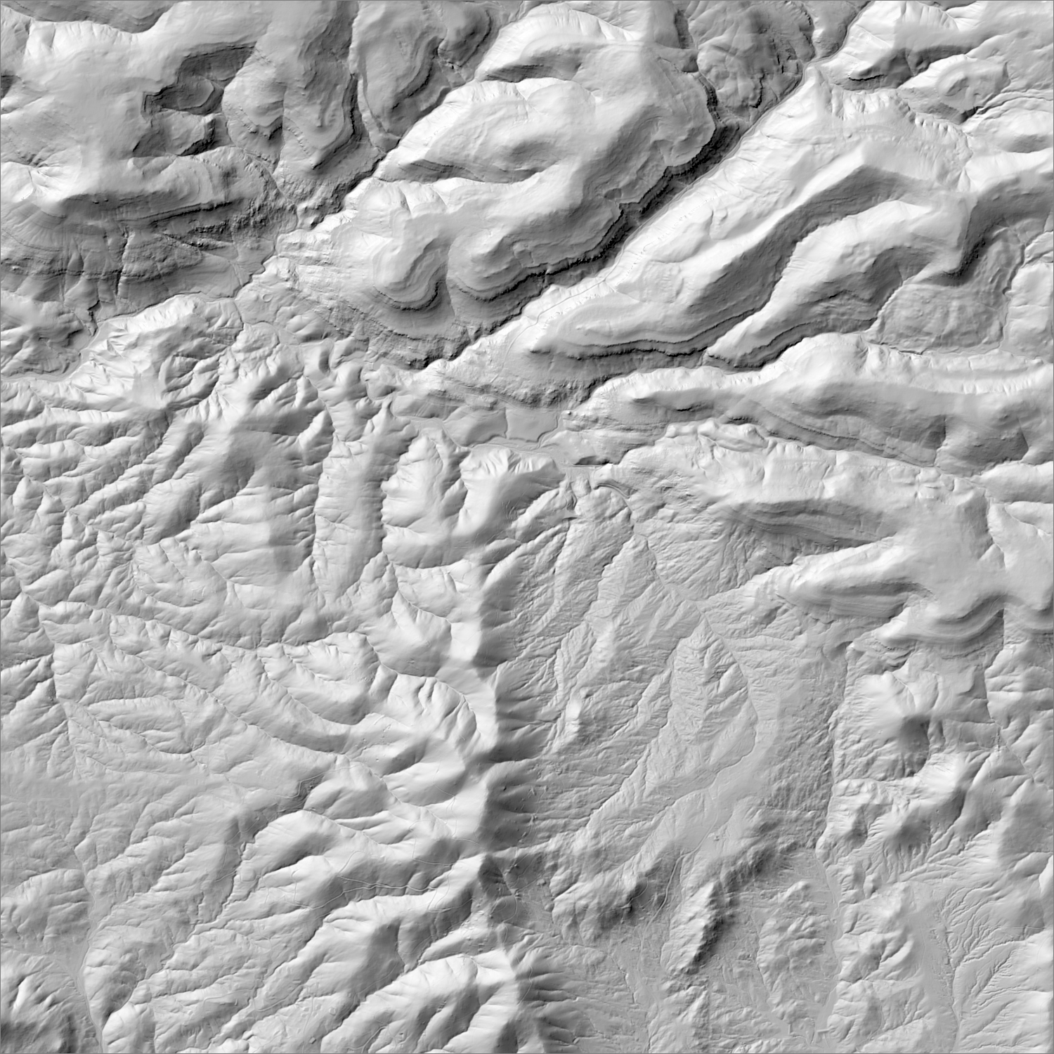
~6 m/pixel lidar-derived hillshade (USGS 3DEP) — fine enough to reveal old mine workings, waste-rock piles, trenches, and roads the statewide terrain layer can’t show.
Historical production
~147,600 oz Au cumulative, lode + placer, 1860–1959 (Western Mining History, Grant Co. tables). The Pacific vein mine alone exceeded $1M in production by 1905. Modern base-metal skarn mine (Cu-Zn-Ag) operated 1948–1995, closed on reserve exhaustion. Placer production specifically has an unresolved 3x conflict between two USGS sources: ~50,000 oz (Johnson 1972, Bulletin 1348) versus 142,647 oz (Koschmann & Bergendahl 1968) — neither this map nor the underlying literature reconciles the two.
Sources: USGS MRDS; EPA Superfund site profile (Non-NPL); Grant County Beat; KRWG Public Media (Mar. 2026); NM Wild; USGS Bull. 1348 (Johnson 1972); USGS Professional Paper 610 (Koschmann & Bergendahl 1968) researched — see sources
Current status
No production. In Nov. 2024, Ivanhoe Electric (via Pinos Altos Exploration LLC) staked 642 lode claims (13,264 acres) targeting a porphyry copper system; withdrew its Plan of Operations Feb. 2026 citing “marginal prospectivity” after sustained community opposition (3,100+ petition signatures) tied to the Gila Wilderness gateway location. As of March 2026, Kennecott Exploration (Rio Tinto) filed 250 claims (~5,000 acres) on nearby Gila National Forest land.
Active within ~12 months
Kennecott Exploration (Rio Tinto) filed 250 new lode claims (~5,000 acres) on nearby Gila National Forest land, weeks after Ivanhoe Electric withdrew its own claims.
Land ownership & directions
U.S. Forest Service land — open to mineral entry under the 1872 Mining Law, but surface use is regulated by the Forest Service and may include wilderness-adjacent or sensitive-area restrictions.
Gila National Forest, adjacent to the Continental Divide Trail and Gila Wilderness gateway. ~8 mi NE of Silver City via NM-15, paved to the townsite.
See specimen photos (mindat.org) → — this app doesn’t host specimen photos itself; this searches mindat.org’s own mineral-specimen database, which isn’t necessarily specific to this exact district.
This pin is a generalized district/historic-site reference point, not a surveyed claim boundary — routes may cross private or patented inholdings where public access isn’t guaranteed even if a road reaches the site. Backcountry mine areas commonly have unmarked shafts, unstable ground, and no cell service; confirm current access and safety conditions (land manager, county, or landowner) before heading out.
Tailings reprocessing potential
Older stamp-mill-era gold-silver production (Pacific vein, pre-1900s–1955) plus a base-metal-focused skarn concentrator (1948–1995) where gold was a tertiary byproduct — two separate eras of likely under-recovery.
This is a documentary heuristic, not assay data.The tier above is inferred from historic production era, processing method, and ore character already cited elsewhere on this page — nobody has sampled or assayed this district’s tailings as part of this research. Actual recoverable gold content can only be established by physical sampling.
Reprocessing tailings is regulated mining. Disturbing or reprocessing historic mill waste requires the same NM Mining Act permitting as new mining (see the regulatory companion guide), regardless of who currently holds the claim or surface rights — and ownership of the tailings material itself is a separate legal question from mineral rights on the underlying land.
Legacy tailings can be hazardous. Pre-modern processing commonly used mercury (amalgamation) or cyanide (heap leach), and can carry elevated arsenic and other heavy metals — not a casual sampling target, and disturbing contaminated material can carry real environmental liability.
Geologist’s read
This is the clearest current example in the state of permitting/social risk overriding geological interest: the withdrawal wasn't about the rock — it was community opposition at a sensitive wilderness-gateway location, and Ivanhoe's own stated reason for pulling out was middling target quality, not regulatory denial. Worth treating as a cautionary comparable for any nearby claim evaluation.
