Red River
Deposit type & geology
Two distinct settings: Proterozoic metamorphic-hosted quartz veins (south, near Gold Hill) and Miocene volcanic/granite-hosted quartz-pyrite veins (north/central).
Precambrian hornblende gneiss, schist, and quartzite (south) and Miocene soda granite with associated volcanics (north), astride the Rio Grande rift.
Age: Precambrian host rocks of uncertain vein age; separately, Miocene quartz veins K-Ar dated at 21.0–23.5 Ma, contemporaneous with early Rio Grande rift extension.
Structural geology & terrain
Vein/structure orientation: Two vein groups: N10°W–N10°E, and N65°E–S70°E; small faults mostly N30°E–N50°E
Named controlling structure: Frazer copper shear zone (E-W, up to 200 ft wide); monzonite dikes along tension fractures on a regional anticline
Elevation range: 8,500–12,600 ft (Gold Hill peak, 12,600 ft)
Rugged high-alpine Sangre de Cristo terrain, glacial cirques, dense fir/aspen/pine forest; high groundwater historically hindered deep mining.
High-resolution terrain
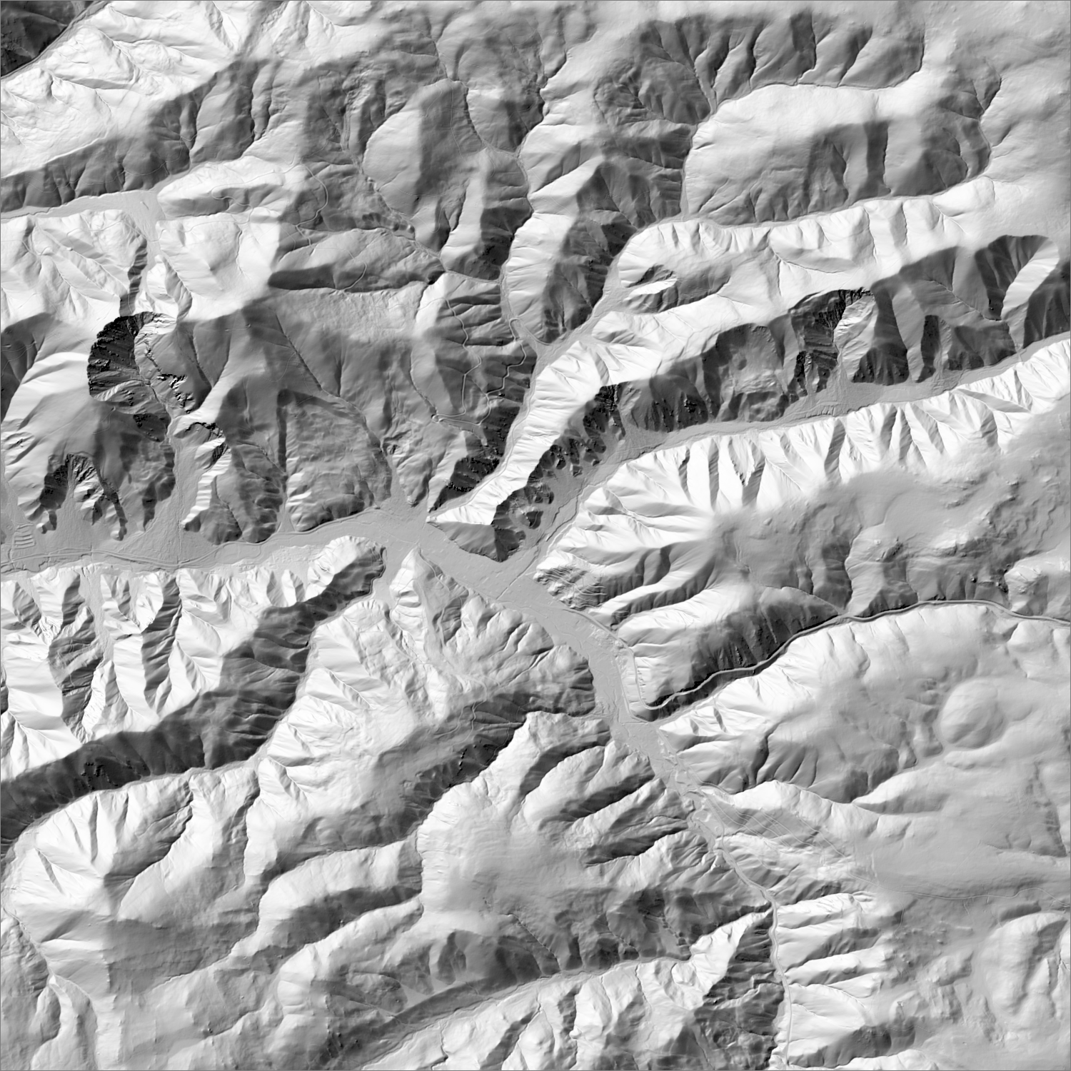
~6 m/pixel lidar-derived hillshade (USGS 3DEP) — fine enough to reveal old mine workings, waste-rock piles, trenches, and roads the statewide terrain layer can’t show.
Historical production
Small and inconsistently reported: two independent NMBGMR-compiled figures give 207 troy oz Au / 5,107 oz Ag (1907–1956) versus 365 oz Au / 8,051 oz Ag (1902–1956) — different source compilations covering overlapping periods, not additive. McLemore & North (1984) separately estimate under 500 oz of placer gold historically. Total district value exceeds $100,000 (NMBGMR Resource Map 24).
Sources: NMBGMR Circular 18 (Park & McKinlay 1948); McLemore & North (1984); NMBGMR Resource Map 24 (McLemore 2017); USGS MRDS researched — see sources
Current status
Minor historic producer, inactive since the mid-20th century. Not to be confused with the nearby Questa molybdenum mine (1918–2014, Molycorp/Chevron) — a much larger, geologically distinct operation that sometimes shared the “Red River” name historically before NMBGMR formally split the district codes.
Recency not verified
No NI 43-101 report, SEC filing, or EMNRD/BLM permit record found for active gold exploration in this district. One small modern claim listing (a 20-acre lode/placer claim called “Spanish Main”/“Governors Mine”) was found via a mineral-property brokerage site, but its current legal claim status could not be confirmed.
Land ownership & directions
U.S. Forest Service land — open to mineral entry under the 1872 Mining Law, but surface use is regulated by the Forest Service and may include wilderness-adjacent or sensitive-area restrictions.
Carson National Forest, largely within or adjacent to the Columbine-Hondo Wilderness. Town of Red River, Taos County, via NM-38; Gold Hill (the district's namesake peak, 12,716 ft) sits within the wilderness area — high-clearance/foot access only.
See specimen photos (mindat.org) → — this app doesn’t host specimen photos itself; this searches mindat.org’s own mineral-specimen database, which isn’t necessarily specific to this exact district.
This pin is a generalized district/historic-site reference point, not a surveyed claim boundary — routes may cross private or patented inholdings where public access isn’t guaranteed even if a road reaches the site. Backcountry mine areas commonly have unmarked shafts, unstable ground, and no cell service; confirm current access and safety conditions (land manager, county, or landowner) before heading out.
Tailings reprocessing potential
Very small documented production (a few hundred ounces) implies minimal tailings volume.
This is a documentary heuristic, not assay data.The tier above is inferred from historic production era, processing method, and ore character already cited elsewhere on this page — nobody has sampled or assayed this district’s tailings as part of this research. Actual recoverable gold content can only be established by physical sampling.
Reprocessing tailings is regulated mining. Disturbing or reprocessing historic mill waste requires the same NM Mining Act permitting as new mining (see the regulatory companion guide), regardless of who currently holds the claim or surface rights — and ownership of the tailings material itself is a separate legal question from mineral rights on the underlying land.
Legacy tailings can be hazardous. Pre-modern processing commonly used mercury (amalgamation) or cyanide (heap leach), and can carry elevated arsenic and other heavy metals — not a casual sampling target, and disturbing contaminated material can carry real environmental liability.
Geologist’s read
Genuinely minor — included mainly because “Gold Hill” led here, and because it illustrates a real naming trap: older literature and even some MRDS-derived sources use “Red River district” as a loose umbrella that includes the much larger Questa molybdenum deposit, but NMBGMR's current classification treats them as entirely separate districts with different dominant commodities. Don't let this district's small gold numbers get inflated by conflating it with Questa's industrial-scale moly production. Also formally distinct per NMBGMR RM-24: the Twining (Rio Hondo) District (DIS240), immediately adjacent, with an 1869 gold placer discovery but negligible ($5,000) production — treated here as a footnote on this entry rather than a separate district.