Santa Rita / Chino
Deposit type & geology
Laramide porphyry copper with byproduct gold-silver.
Santa Rita quartz-monzodiorite to granodiorite stock intruding Precambrian basement and metasedimentary rock.
Age: Santa Rita stock ~58–59 Ma (Laramide).
Structural geology & terrain
Vein/structure orientation: Stock elongate NW-SE; mineralization localized at the junction of NW, NE, and E-trending fault sets
Named controlling structure: Barringer fault (NW boundary of the horst — MRDS itself mislabels this the "Silver City fault"; the more authoritative USGS PP555 confirms Barringer fault is correct) and Mimbres fault (NE boundary); Carbonate/Romero fault (N55–65°E/50–70°SE at the pit); Fort Bayard arch (regional control)
Elevation range: 6,401 ft at the pit; quadrangle range 5,790–8,054 ft
Basin & Range terrain, pinyon-juniper/oak on lower slopes to conifer higher up; the historic townsite was physically removed by pit expansion.
High-resolution terrain
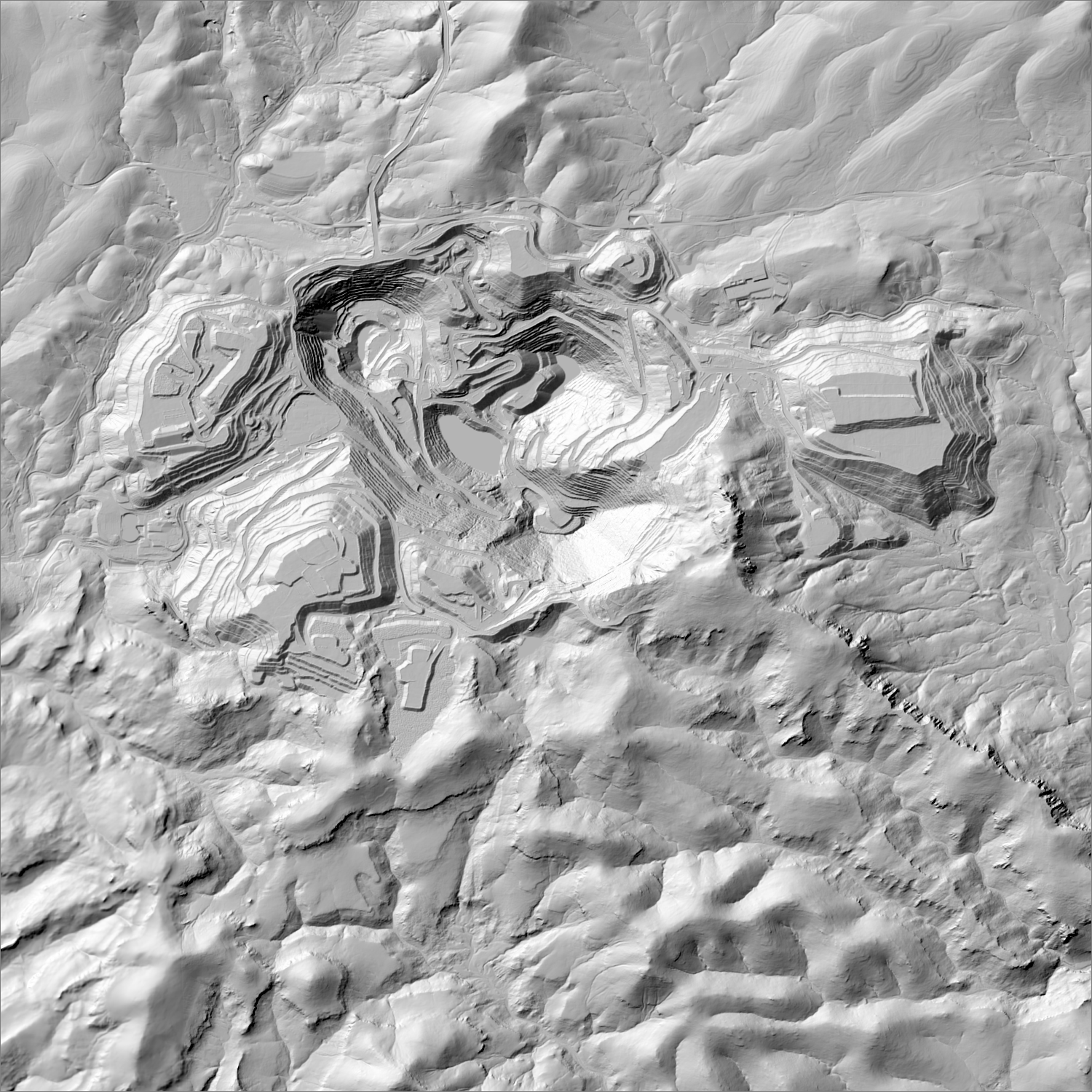
~6 m/pixel lidar-derived hillshade (USGS 3DEP) — fine enough to reveal old mine workings, waste-rock piles, trenches, and roads the statewide terrain layer can’t show.
Historical production
More than 5.9M tons Cu, 500,000+ oz Au, and 5.36M oz Ag, 1911–2006 — the largest copper-and-gold district in New Mexico by cumulative value.
Sources: NMGS Guidebook 59 (McLemore 2008); NMBGMR Chino Mine tour page; USGS Professional Paper 610 (Koschmann & Bergendahl 1968, cross-referenced) researched — see sources
Current status
Actively producing. Freeport-McMoRan operates the Chino open-pit copper mine, with gold and silver recovered as byproducts of copper processing.
Active within ~12 months
Continuously operating — Freeport-McMoRan reported 150 million lb of copper production in 2025, with gold/silver recovered as byproducts.
Land ownership & directions
Privately held — a mix of patented mining claims, ranch land, and corporate holdings. Mineral and surface rights may be held separately (split estate); accessing or exploring here requires the owner's permission or a lease/purchase agreement, not a BLM claim filing.
Private/patented, Freeport-McMoRan-owned. On NM-152 at Santa Rita, paved highway access.
See specimen photos (mindat.org) → — this app doesn’t host specimen photos itself; this searches mindat.org’s own mineral-specimen database, which isn’t necessarily specific to this exact district.
This pin is a generalized district/historic-site reference point, not a surveyed claim boundary — routes may cross private or patented inholdings where public access isn’t guaranteed even if a road reaches the site. Backcountry mine areas commonly have unmarked shafts, unstable ground, and no cell service; confirm current access and safety conditions (land manager, county, or landowner) before heading out.
Tailings reprocessing potential
Over a century of continuous, massive-scale copper-focused milling (5.9M+ tons processed) with gold and silver as byproducts, not the primary target — one of the largest legacy tailings volumes in the state by sheer scale.
This is a documentary heuristic, not assay data.The tier above is inferred from historic production era, processing method, and ore character already cited elsewhere on this page — nobody has sampled or assayed this district’s tailings as part of this research. Actual recoverable gold content can only be established by physical sampling.
Reprocessing tailings is regulated mining. Disturbing or reprocessing historic mill waste requires the same NM Mining Act permitting as new mining (see the regulatory companion guide), regardless of who currently holds the claim or surface rights — and ownership of the tailings material itself is a separate legal question from mineral rights on the underlying land.
Legacy tailings can be hazardous. Pre-modern processing commonly used mercury (amalgamation) or cyanide (heap leach), and can carry elevated arsenic and other heavy metals — not a casual sampling target, and disturbing contaminated material can carry real environmental liability.
Geologist’s read
The largest gold producer on this map by cumulative ounces — but every ounce is a byproduct of copper milling, not a standalone gold target. It illustrates the scale difference between NM's porphyry-copper gold and its dedicated gold-vein/placer districts. Note: USGS's historic “Central Mining District” classification (Koschmann & Bergendahl 1968) sometimes bundles Santa Rita with the nearby Fierro-Hanover and Georgetown-area workings under one name and a much lower combined total (~140,000 oz, 1904–1959); NMBGMR's own district database (McLemore, Resource Map 24) instead treats these as separate, individually-coded districts, consistent with how they're broken out on this map (see the Fierro-Hanover and Georgetown entries).
